Correction of GNSS multipath effects for reliable autonomous localisation of highly automated vehicles in metropolitan areas (KOMET)
 © Ch. Skupin (Bosch)
| Led by: | Prof. Dr.-Ing. Steffen Schön, Dr.-Ing. Tobias Kersten |
| E-Mail: | ruwisch@ife.uni-hannover.de |
| Team: | Dr.-Ing. Tobias Kersten, M.Sc. Fabian Ruwisch |
| Year: | 2020 |
| Funding: | BMWi / TÜV Rheinland Consulting GmbH |
Research focus


 ©
KOMET group
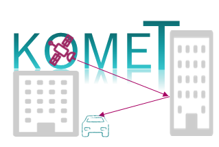
Auto-localization is a highly relevant functionality for the safety of automated driving. The GNSS (Global Navigation Satellite System) sensor holds a unique role in this context, as only this sensor enables global positioning in a superordinate coordinate system. On the other hand, compared to other sensors, such as video and radar, it has important complementary properties for sensor fusion to ensure localisation. The required precision in the sub-decimeter range of GNSS sensors is only guaranteed by carrier phase observation. The code range (code measurement) used in automotive applications often lacks the required positioning resolution due to its high measurement noise. The complex GNSS signal propagation (signal shading, multipath effects) in urban environments makes the determination of an accurate and robust positioning solution a particularly challenging task - e.g. for positioning in narrow street canyons. The research project aims to develop and implement innovative correction methods to reduce multipath effects in order to improve carrier phase-based GNSS positioning.
At the present state-of-the-art, reliable positioning in urban environments for highly automated driving can only be achieved by a comprehensive fusion of a GNSS sensor with various costly sensors (radar, video, lidar). If the GNSS sensor, which is necessary anyway, can be increased in its accuracy and robustness with the correction methods to be developed, the reliable localisation procedure can be realised with considerably less effort for additional sensors. The project contributes to the goal of helping highly automated driving in inner-city areas to achieve economic progress.
Driverless transportation (such as Robo-Taxi and/or -shuttle) requires maximum reliability of localization. With today's state-of-the-art technology, a remote control system is provided which, if necessary, takes over manual remote control of the vehicle. With the method to be developed here, the reliability of the locating is increased so that driverless transportation with less remote intervention could be realized more efficiently.
Meeting the goals of the project and processing the six defined packages is based on the following essential work steps. The first step consists of defining and collecting the situations and requirements that are relevant for automated driving. The collection of a unique GNSS database for kinematic and static situations is the second work step and simultaneously provides the study data required for the project. The third step is concerned with the quantification of the error influences of purely GNSS-based urban positioning and provides a comparative solution that is achievable according to the current state of the art in science and technology and whose quality will be specifically improved within the framework of the project.
Identification, definition and characterization of the essential parameters are carried out in the fourth step. The dominant and degrading identified parameters will be modelled in a compact form in the fifth step. Corrections for their treatment will be derived and interfaces and formats for their exchange are developed. The implementation and testing of suitable procedures for the application of the new corrections in the GNSS receiver is carried out in the sixth step. At the end of the joint project, a demonstration of the overall concept will be carried out for application in a real environment.
Part of the professorship in the project
At IfE we focus on the development of the methodological concepts and mathematical modelling of GNSS signal characteristics as well as on the analysis of the required model parameters for the description of GNSS signal characteristics as a basis for correction concepts. The extensive knowledge and existing skills for coupling GNSS and IMU for the evaluation of static and kinematic GNSS trajectories will be brought into the project and the partners will be supported accordingly. The IfE will contribute its comprehensive GNSS analysis and evaluation software (GNSS Toolbox V6.1) and use it for the detailed and dedicated characterization and classification of urban GNSS positioning. Technical discussions and the existing expertise within the working group by specialists from related fields (inertial navigation, collaborative navigation, receiver clock modelling etc.) will be very useful in this context. A further focus is ensured by the IfE in the area of research data management according to the FAIR rules1 (European Commission, 2016)2.
1FAIR: Findable, Accessible, Interoperable, Re-usable), Prinziples for sharing and exchanging research data (cf. European Commission (2016))
2European Commission (2016). H2020 Programme – Guidelines on FAIR Data Management in Horizon 2020, Version 3, Directorate-General for Research & Innovation


