-
Transport der TZK2-D zu Messungen mit Kleinbus.
-
Digitale Zenitkamera TZK2-D bei Messungen in den Alpen

Based on the conventional transportable zenith camera TZK2 that had been used with great success at the Institute of Geodesy in previous years, a new transportable high-precision and mostly automated real-time zenith camera TZK2-D was developed (transportable zenith camera 2 – digital system).
The depiction of stars close to the zenith using a CCD sensor enables the system to provide plumb-line parameters (astronomical latitude and longitude) with a precision of 0.1 arc seconds. The system is used in connection with a GPS receiver to determine astro-geodetic vertical deflections, which are utilized for the high-resolution determination of the gravity field in local and regional ranges.
-
Method
The digital zenith camera system consists of two main components. With the zenith camera the vertical parameters, the astronomical latitude Φ and length Λ, are determined. The integrated GPS receiver delivers the ellipsoid coordinates latitude Φ and longitude λ. The astro-geodetic vertical deflection components north-south ξ and east-west η are then defined in linear approximation as
ξ = Φ - φ
η = (Λ - λ) cos φ.The transition from astro-geodetic vertical deflections to (quasi)geoid heights is done along profiles using astronomical, respectively astronomical-topographic levelling.
-
Design
The digital zenith camera system TZK2-D consists of the transportable zenith camera TZK2, a CCD sensor (KX2E, Apogee) for digital image capture, a GPS receiver (Z12, Ashtech) for time measurement and determination of the ellipsoid coordinates, two electronic tilt sensors (HRTM) and an industrial computer. The industrial computer is used for the steering of the sensors of the zenith camera system, the measurement data acquisition and storage as well as the immediate data processing in the field. The entire measuring system, including the computer, is integrated into a dolly, which can be lifted for measuring with three motor cylinders.
-
Sensor Technology
High-Precision Tilt Measurement with Sensors HRTM
High-precision tilt sensors type HRTM (High Resolution Tiltmeter, Lippmann Geophysikalische Messgeräte) are used to establish the connection between camera and physical plumb-line with a precision of 0.04 to 0.05 arc seconds.
Digital Image Capture
The central piece of the digital zenith camera is the CCD sensor KAF 1602E with 1530 x 1020 image elements, which enables the capture of stars up to an apparent magnitude of 14 mag. Spread out across the entire celestial sphere over 13 million stars are available for vertical determination. The effective field of view of the zenith camera corresponds to 47.4 x 31.6 arc minutes. One single zenith photo contains on average 20-30 stars.
Data Processing
Crucial for the determination of the plumb-line with a digital zenith camera system is the availability of analytical software with real-time capability that automatically calculates the vertical parameters from digital images of the zenith star field, using a star catalogue as a reference. For the analysis of the measurements done by the zenith camera at the Institute of Geodesy the evaluation system AURIGA (Automatic Realtime Image Processing System for Geodetic Astronomy) was developed. It provides a fully automated analysis of the measurement data and offers various options to visualize measurement data and results.
On an efficient industrial computer the analysis of the zenith camera measurements in two layers takes between 3 to 5 seconds.
Because of the immediate availability of the results in the field the inner precision can be determined. For the analysis of the zenith camera images the star catalogues Tycho-2 and the United States Naval Observatory CCD Astrograph Catalogue (UCAC3) are used.
-
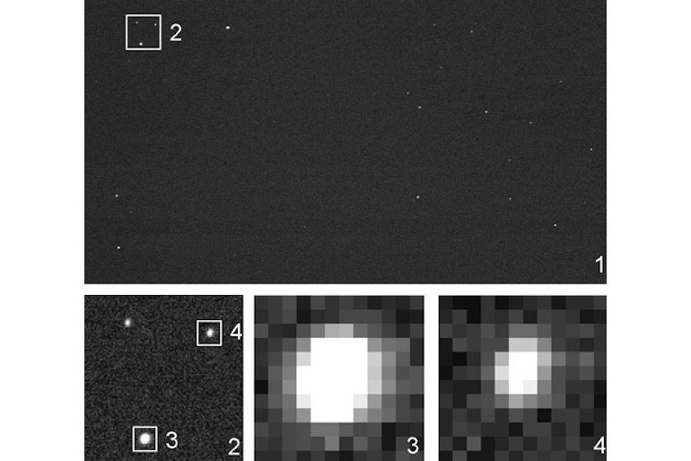
Digitale Zenitaufnahme: Oben das gesamte Bildfeld, die Bilder 2-4 zeigen vergrößerte Sternabbildungen. Der Abbildungsmaßstab der Aufnahmen beträgt 1.86 Bogensekunden/Pixel (Hirt und Seeber, 2002).
-
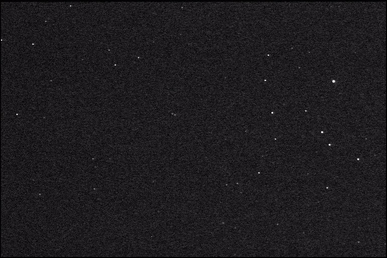
Digitale Zenitaufnahme
-
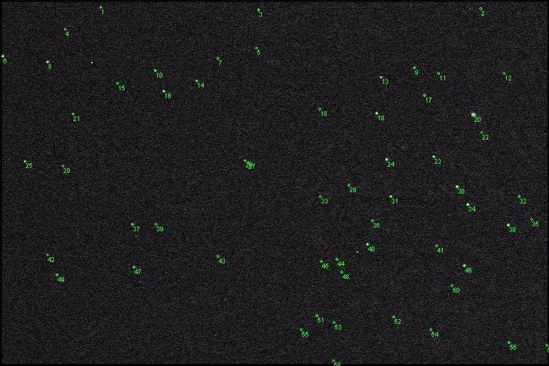
Extrahierte Sterne
-
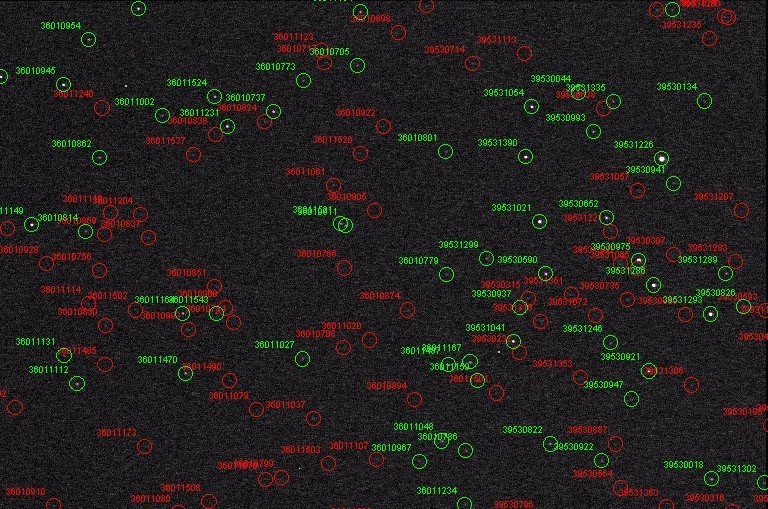
Sternenfeld aus dem Sternkatalog
Determination of Vertical Deflections in Germany

 ©
IfE/C. Voigt
©
IfE/C. Voigt
Since 2004 the zenith camera system TZK2-D has been used for the high-resolution determination and validation of physical height reference surfaces.
Here, in particular the high-resolution quasigeoid determinations of Dr.-Ing. Christian Hirt in the Estergebirge and Harz Mountains along local profiles of ca. 20 and 60 km respectively should be mentioned.
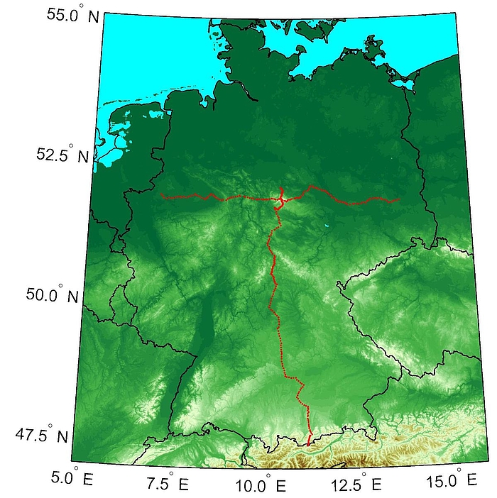
Since 2006 the zenith camera system is used for the collaborative research project REAL GOCE for the high-resolution gravity field determination along two regional profiles with 500 km each in length (see image).
This set of data is used for the cross validation with GPS/levelling data and gravimetric quasigeoid models on the one hand and on the other for the regional validation of global gravity field models, especially for the satellite mission GOCE.
Selected Publications
-
(2002): Astrogeodätische Lotabweichungsbestimmung mit dem digitalen Zenitkamerasystem TZK2-D, Zeitschrift für Vermessungswesen 127: 388-396 More info
-
(2013): Astrogeodätische Lotabweichungen zur Validierung von Schwerefeldmodellen, Wissenschaftliche Arbeiten der Fachrichtung Geodäsie und Geoinformatik der Leibniz Universität Hannover, Nr. 305 More info
-
(2014): Validation of Second-Generation GOCE Gravity Field Models by Astrogeodetic Vertical Deflections in Germany, Earth on the Edge: Science for a Sustainable Planet, Proceedings of the IAG General Assembly, Melbourne, Australia, June 28 - July 2, 2011, International Association of Geodesy Symposia, Vol. 139, Springer, 291-296
DOI: 10.1007/978-3-642-37222-3_38


